
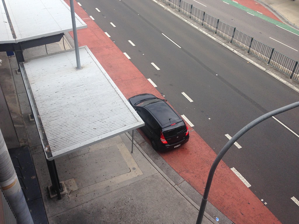
A low-floor bus can have a working wheelchair ramp and still be inaccessible. If a parked car occupies the approach to the stop, the driver may be unable to bring the bus close enough to the kerb. The vehicle’s accessibility technology has not failed. The street’s allocation has.
The kerb is often treated as the leftover edge of a road: somewhere to store a car, unload a van or place a sign. In practice it is a scarce public interface. The same few metres may need to serve a bus for thirty seconds, a delivery for ten minutes, a passenger with limited mobility at an exact doorway, a cycle lane continuously and residents who want long-term parking.
The central question is therefore not how to maximise “kerb use”. It is which public purposes should have reliable access, at which times, and how conflicts should be seen and corrected. A kerb is a timetable written on the street.
Paint and signs are a scheduling system
A yellow line, bus-stop cage or loading sign looks static, but each encodes time. Some uses are permitted only during stated hours. Others depend on vehicle type, duration, payment or a permit. Enforcement turns those rules into a practical schedule.
The mechanism matters because kerb users have different time profiles. A parked private car may occupy one space for hours. A delivery vehicle needs short but predictable access near a destination. A bus needs the same location repeatedly, with enough clear approach and exit space to meet the kerb. Someone using a wheelchair-accessible taxi may need a level boarding point for only a few minutes, but cannot simply substitute a space fifty metres away.
These demands are not interchangeable. Counting occupied spaces tells an authority how full the kerb is, not what the kerb enabled. A block can report high utilisation while buses cannot board safely, deliveries double-park and dropped-off passengers must enter the carriageway.
Transport for London’s kerbside loading guidance makes the trade-off explicit. Deliveries and servicing are necessary to local life, yet stopping in the wrong place or time can harm pedestrians, cyclists, buses and road reliability. It recommends understanding each street through local observation before choosing a response, rather than applying one standard arrangement everywhere.
What digital kerbs can—and cannot—decide
Cities are beginning to turn kerb rules into data. A digital inventory can describe the location, length, permitted uses and hours of every segment. Sensors or payment records can show when a loading zone is occupied. Digital permits can make commercial access easier to administer, and an open data feed can tell drivers where a legal space is likely to exist before they arrive.
This is no longer merely a proposal. The US Department of Transportation’s SMART programme lists city pilots for digital kerb inventories, real-time use information, open regulation feeds and technology-enabled delivery zones. Seattle’s completed pilot, published in June 2026, tested a digital commercial-vehicle permit alongside vehicle-detection sensors.
The strongest case for this approach is practical. Better information can reduce circling, illegal stops and administrative friction. Time-specific rules can make one place serve several legitimate needs rather than reserving it for a single use all day.
But a digital representation is not a neutral copy of the street. It records what the system is designed to notice. A vehicle sensor may capture occupancy while missing the wheelchair user who could not board, the cyclist forced into traffic or the delivery worker carrying goods from a distant legal bay. Optimising the easiest signal risks making the public purpose less visible.
Nor can software choose the priority. Whether long-stay parking should yield to loading, a bus stop, trees, seating or an accessible passenger zone is a political and institutional decision. Data can reveal conflicts and test consequences. It cannot supply the value judgement that resolves them.
Accessibility is a property of the whole interface
Kerb access also shows why equipment standards are not enough. TfL’s accessible bus-stop guidance notes that legal or illegal waiting and loading can prevent a bus manoeuvring close to the kerb. The ramp, bus and stop may each meet their individual specification while the combined journey still fails.
This connects to Alkemata’s argument that one broken lift can close an entire journey. Accessibility is a chain. At the kerb, its links include a clear approach, a usable boarding surface, enforcement, current information and a credible alternative when the intended space is blocked.
Responsibility is easily fragmented. A transport operator runs the bus; a highway authority designs the stop; a parking team writes restrictions; contractors enforce them; delivery platforms shape arrival patterns. If performance is measured within each organisation, everyone can meet a target while the passenger still cannot board. The public outcome must therefore cross those boundaries.
Make a one-block kerb diary
A useful first project needs no sensor contract. Choose one block with several competing uses and observe it from a safe public place during three different thirty-minute periods—for example, a delivery peak, a school or commuting peak, and a quieter period.
Draw the kerb as a line divided into approximate five-metre segments. For each stop, record only the category of use and duration: parked vehicle, goods loading, passenger pickup, bus access, cycle obstruction, waste collection or unused space. Separately mark consequences: a blocked dropped kerb, a bus stopping away from the kerb, a delivery from the carriageway, or a pedestrian diversion. Do not record faces, number plates or information that identifies individuals.
The aim is not to produce an enforcement dossier or a precise traffic study. It is to compare three measures:
- occupancy: how long the space was filled;
- service: what useful activity was completed;
- conflict: when one use prevented another from functioning safely or accessibly.
Then ask one bounded question: would a different time window, clearer sign, relocated loading bay, protected boarding area or short enforcement trial reduce the most consequential conflict without simply moving it next door? Any street change should be authorised, reversible and evaluated with affected residents, disabled travellers, workers and businesses—not inferred from observation alone.
A good kerb policy does not promise a frictionless street. It makes priorities visible, gives essential short uses a reliable place, protects those who cannot improvise an alternative and provides a way to revise the timetable when the street changes. The next useful test is not whether the kerb can be made busier. It is whether more people can complete the journeys and tasks for which the street exists.
Author
What concrete example would confirm or challenge this article?
Choose a reaction, write a comment, or ask your AI assistant to send a proposal for review. Comments are reviewed before publication.