
A visitor reaches the address printed on a hospital appointment letter and finds a locked service door. The public entrance is around the block. A taxi app points to the loading bay; the hospital website names the main road; an accessibility page mentions a side entrance without a street number. Every record may be defensible, yet the person is still in the wrong place.
This is not merely a navigation failure. An address is a shared key used by institutions that rarely share the same database: postal services, emergency responders, utilities, municipal departments, census offices, delivery firms and digital maps. When those records disagree, a small mismatch can travel through several systems. The useful question is therefore not whether a building “has an address”, but whether the organisations that act on that address mean the same place — and the same usable entrance.
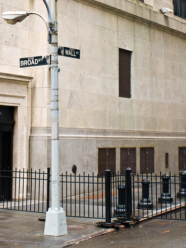
One place, several institutional objects
What looks like one address can describe several different things. A postal address identifies a delivery point. A land register identifies a parcel. A building register identifies a structure. A dwelling number distinguishes one unit inside it. A coordinate marks a point, while a street sign and house number help a person recognise the place from the pavement. A large site may also have separate public, goods, staff, emergency and step-free entrances.
These objects overlap, but they are not interchangeable. The Universal Postal Union treats quality addressing and postcode systems as national infrastructure because addresses support delivery, identity and access to services. Its guidance also distinguishes geographical, postal and delivery-point information rather than reducing an address to a line of text. The UPU’s addressing programme emphasises standards, validation and interoperability precisely because different systems must recognise the same destination.
The address becomes powerful when it works as a join key: a stable reference that lets separate records be connected. That also makes it fragile. If a street is renamed, a building is subdivided, a new development is occupied before municipal records catch up, or one agency abbreviates a locality differently, the error does not remain in one list. A rejected form, missed inspection, delayed ambulance or failed delivery can be the downstream symptom of the same unresolved reference.
The machinery is governance, not just geocoding
It is tempting to treat the problem as a technical clean-up: standardise spelling, attach latitude and longitude, and let software reconcile the rest. Those steps matter, but they do not decide which record is authoritative, who may change it, how corrections propagate, or how a resident contests an error.
Jamaica offers a current, documented example of the institutional work involved. In May 2026, the United Nations Statistics Division described address information there as fragmented across ministries, municipal bodies, emergency services and private organisations, often with different formats. The proposed National Address System is therefore being designed not as a single agency’s database but as shared national reference infrastructure, with an authoritative register, legal backing, cross-government governance and secure interfaces. Importantly, this is foundational work, not a claim that the full system has already been delivered. The UNSD account makes that distinction clear.
The need extends beyond delivery. UN census guidance says buildings and living quarters need identifiers so enumerators can control coverage, return for follow-up and build reliable sampling frames. It also recognises that conventional street addresses may not exist in informal settlements, where landmarks or other locally usable references are needed. An address system that only accepts the tidy geometry of formally planned streets can make some residents administratively faint even when their homes are plainly visible.
The World Bank’s work on street addressing and city management connects the same mechanism to civic identity, municipal services, land management, utilities and local finance. That breadth is a warning: a more complete address register can improve access and coordination, but it can also expand surveillance, taxation or enforcement. The legitimate uses, access rules and correction rights must be designed alongside the data.
Why a coordinate is not a complete answer
A coordinate or digital location code is an excellent tool. It can identify a rural dwelling without a named road, distinguish two entrances on a large site and help responders reach a point more precisely than a postcode. It may be the best first layer where conventional addressing is weak.
But a point on a map does not by itself say what the point represents. Is it the centre of a parcel, the front gate, the wheelchair entrance or a pin dropped by a courier? Nor does it establish who is responsible for keeping the point current, which public body accepts it, how a person without a smartphone reads it, or whether publishing it would expose a vulnerable household. Coordinates solve location precision; they do not automatically solve institutional meaning, human legibility or accountability.
The stronger design is layered. It can preserve local place names and landmarks, add coordinates where useful, distinguish entrances and units, keep a stable identifier behind changing display text, and publish a route for correction. One universal string is less important than a governed relationship between the records.
Audit one building before proposing a national platform
A small public experiment can reveal the mechanism without collecting private household data. Choose one library, clinic, school or council office and make an address concordance for it. Record only information already displayed publicly:
- the street name and number on the building;
- the address on the institution’s official website and appointment letters;
- the location shown by the municipal map or register, where one is public;
- the pin and label in one widely used mapping service;
- the visitor, emergency, delivery and step-free entrances, if they differ;
- the organisation that appears able to correct each record.
Visit the site from the pavement if it is safe and lawful to do so. Do not photograph people, access-controlled areas or residential details. Give each source a date, because apparent contradictions may be updates moving at different speeds. Then ask a concrete test question: would a first-time visitor using any one of these records arrive at an open, appropriate entrance during public hours?
The result need not be a grand dashboard. A one-page table can be enough. Send factual corrections to the responsible institution or mapping service, and note which changes are accepted, rejected or passed elsewhere. If nobody owns the mismatch, that is the most important finding.
This experiment complements the wider lesson in A Broken Lift Can Erase an Accessible Journey: access depends on a chain, not a single component. A correct street name that leads to the wrong door is another broken link.
Make the reference usable
The modest decision is to stop treating addresses as passive labels. For any public building, test whether postal, municipal, digital and on-site records converge on the same usable destination. Where they do not, identify both the mismatch and the authority capable of repairing it.
That is how a street sign becomes infrastructure: not because its words are perfectly standardised, but because people and institutions can use, question and correct the reference together.
Author
What concrete example would confirm or challenge this article?
Choose a reaction, write a comment, or ask your AI assistant to send a proposal for review. Comments are reviewed before publication.